English
 Français


Description
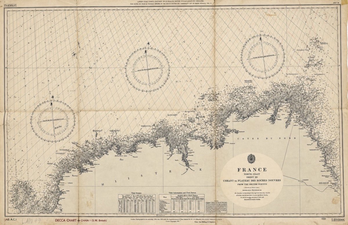
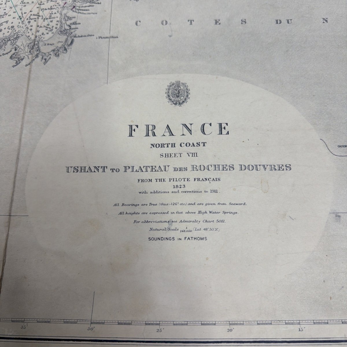
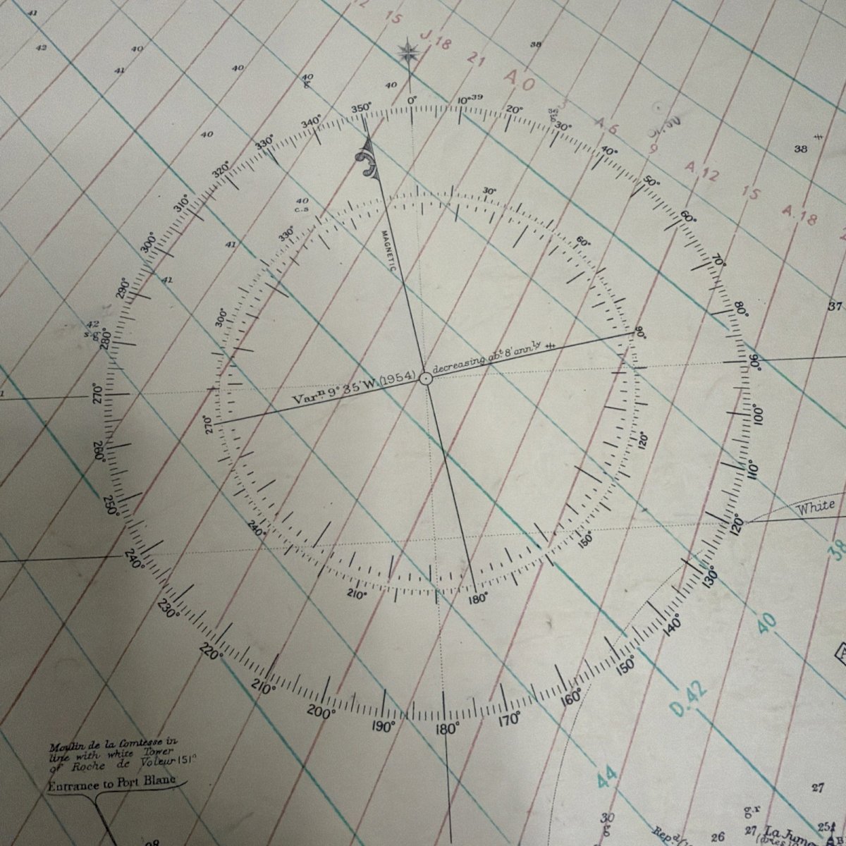
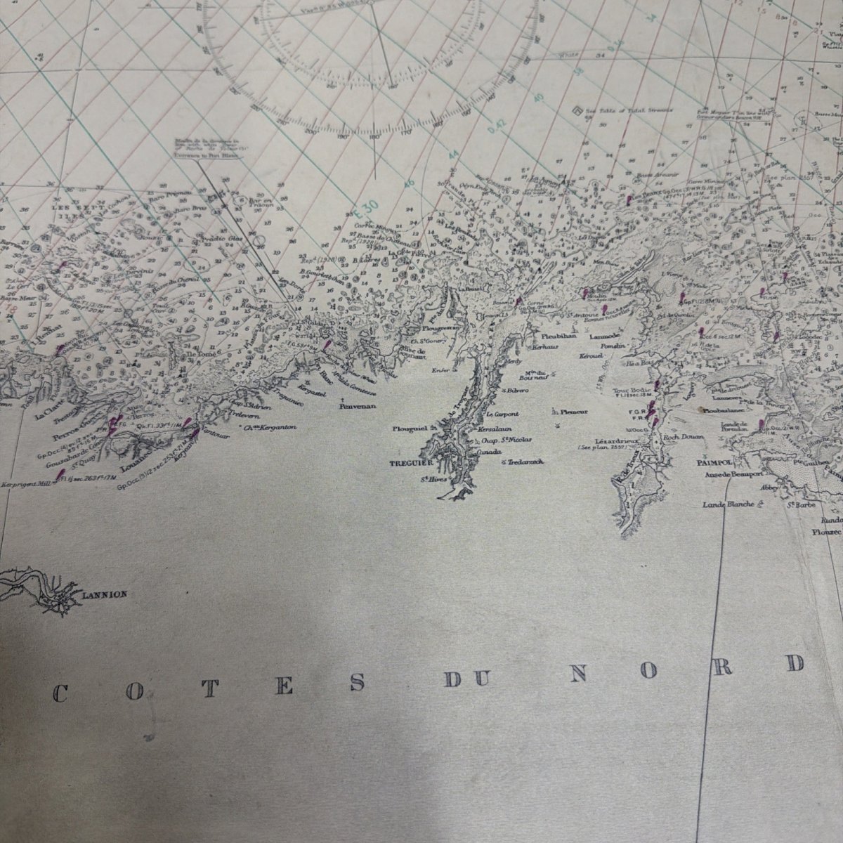
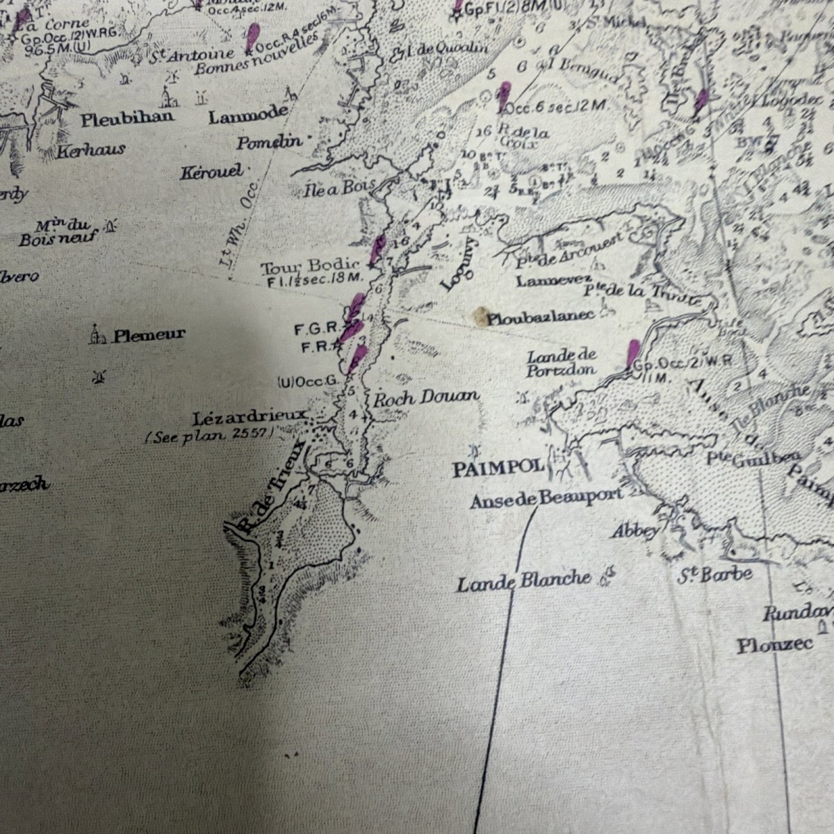
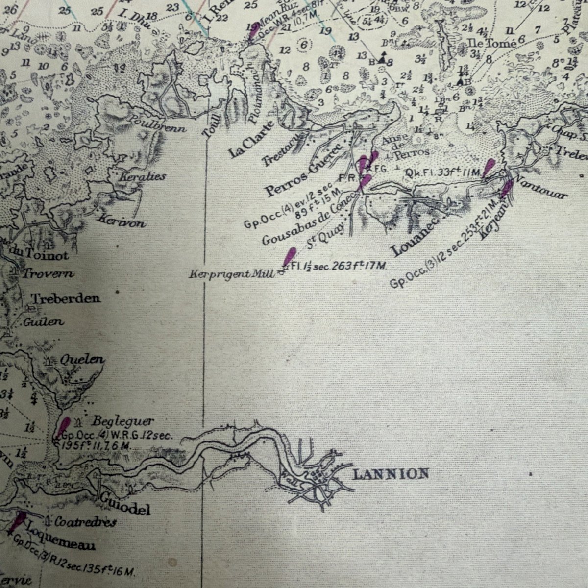
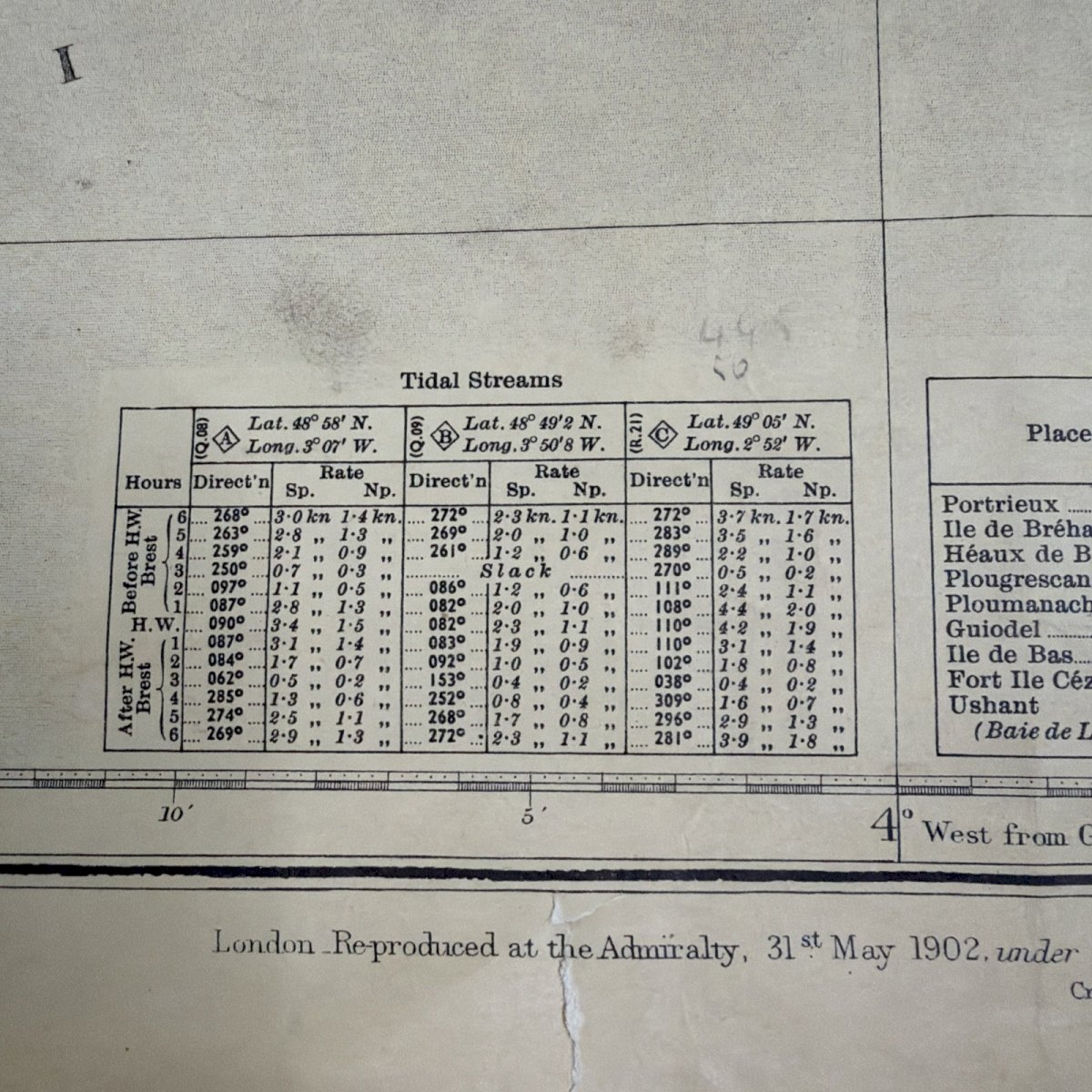
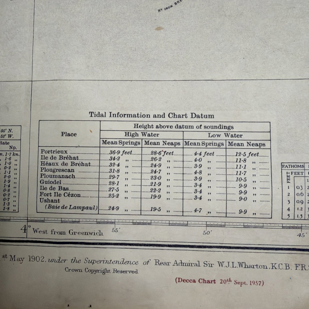
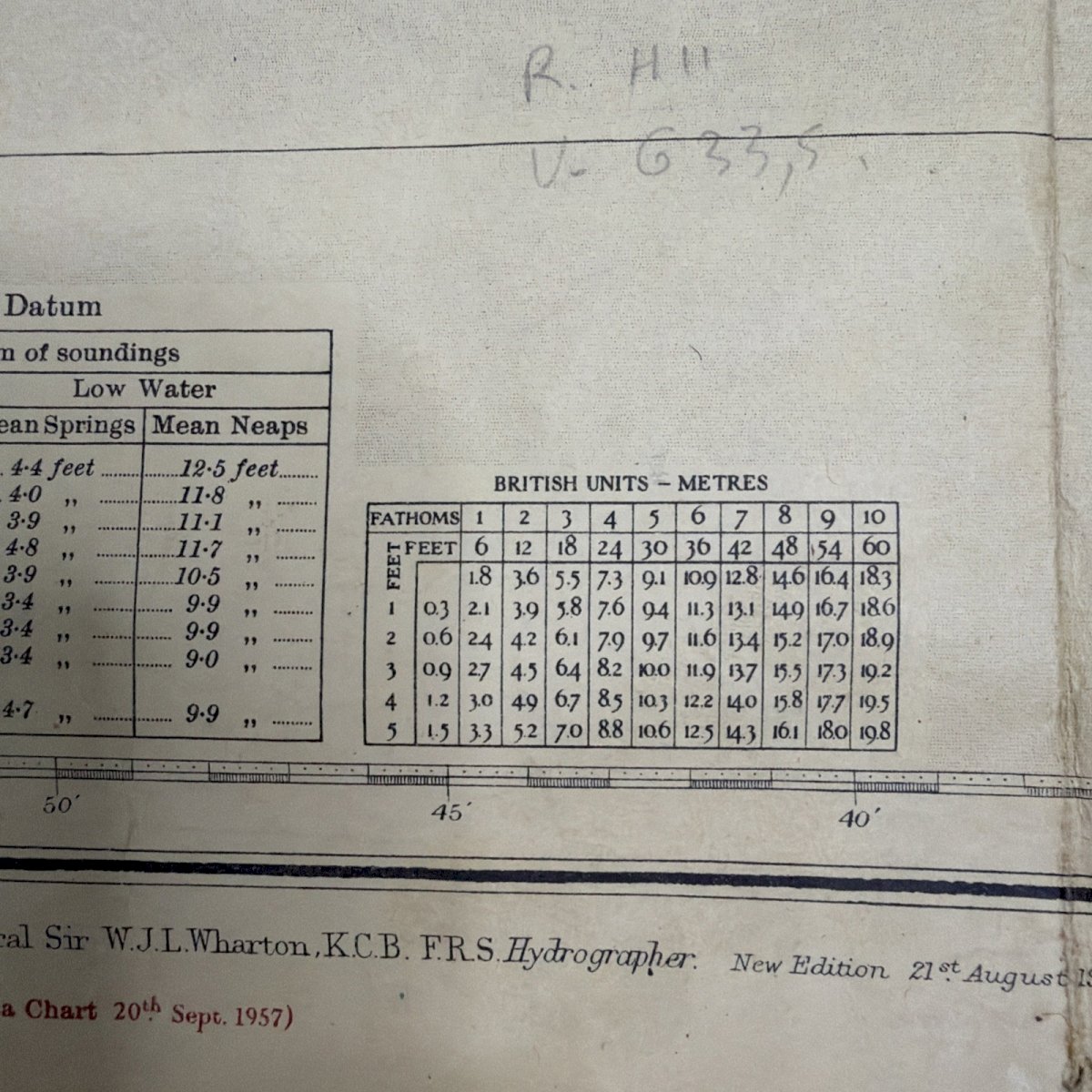
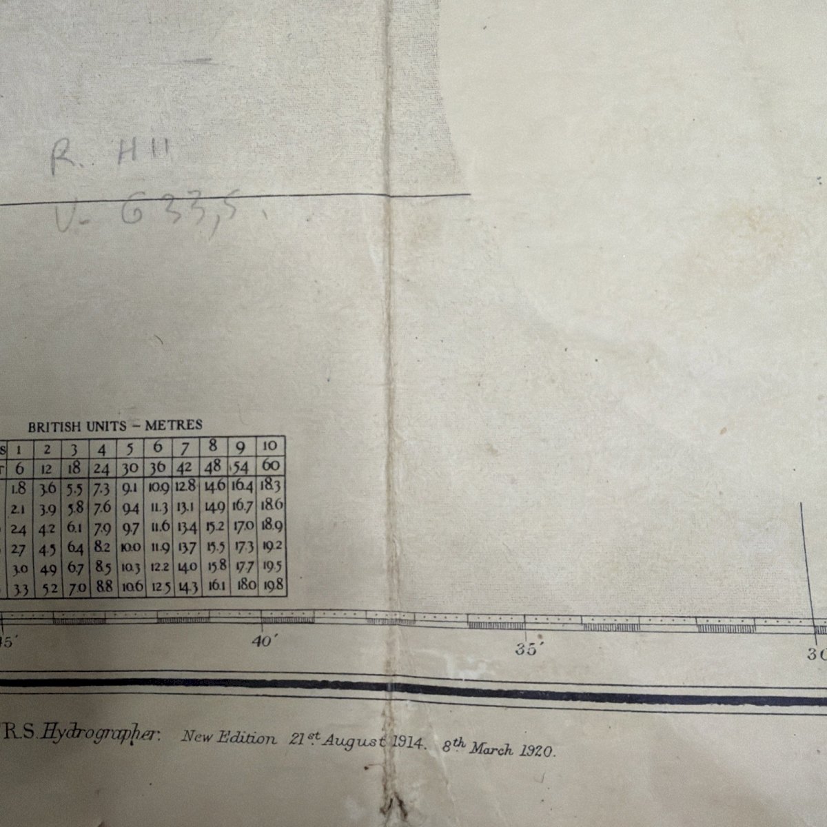
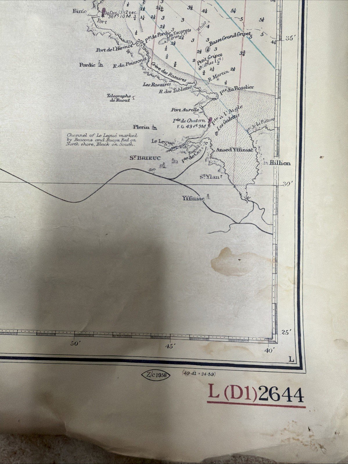
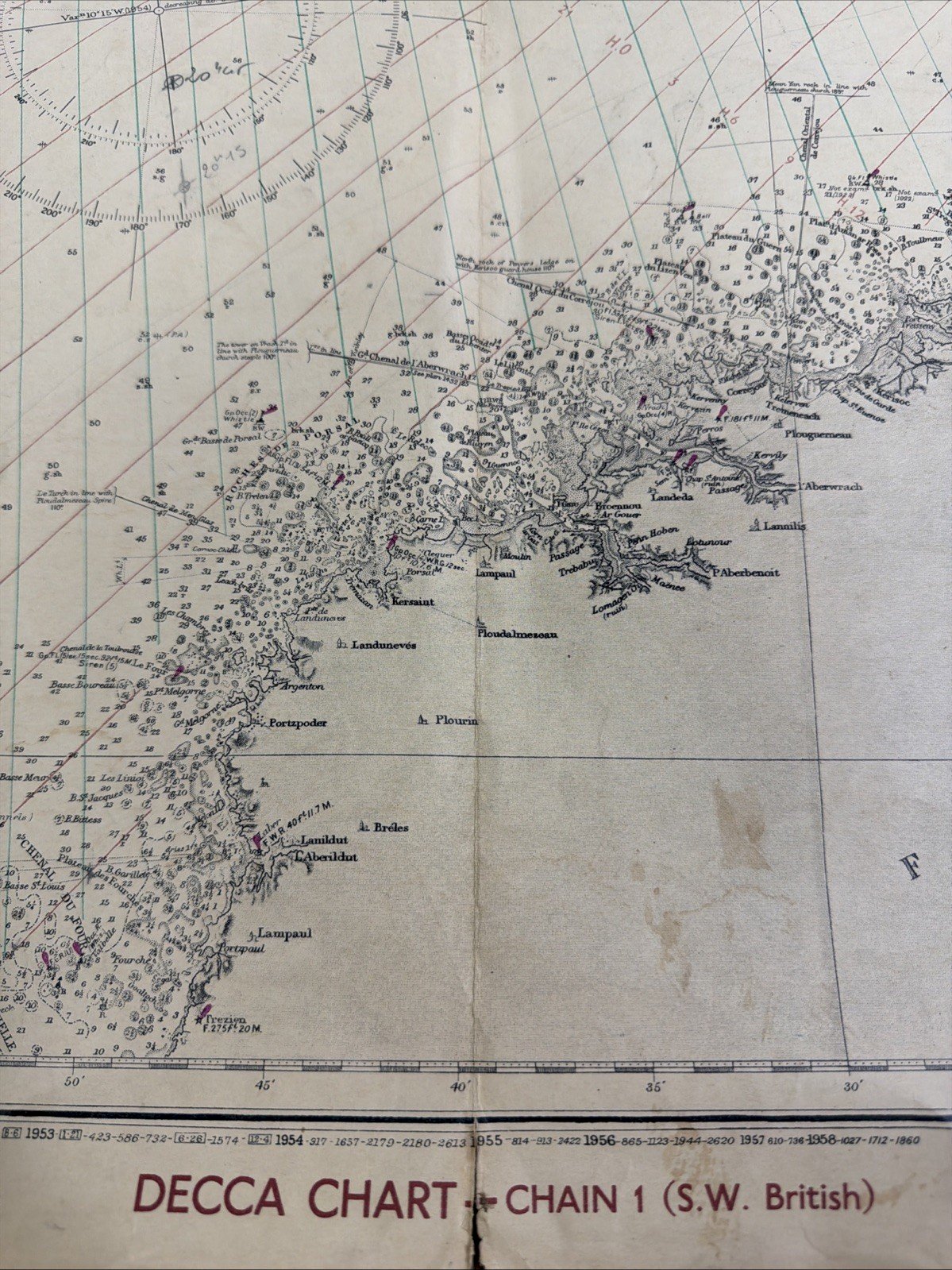
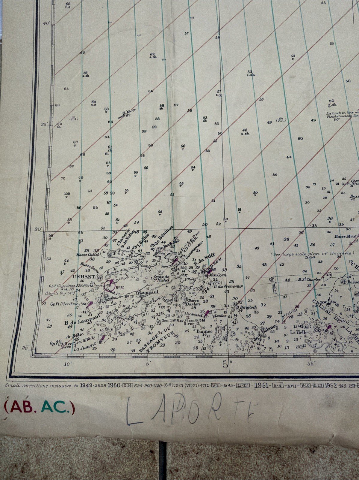
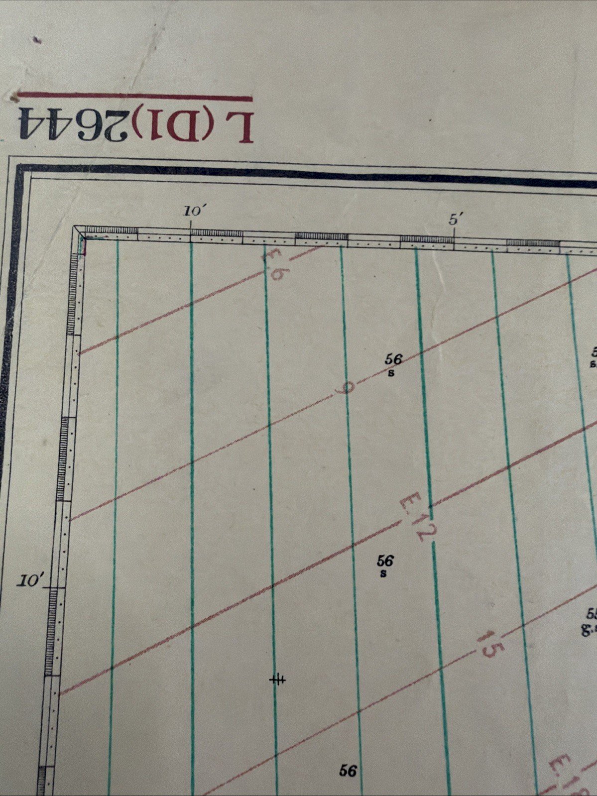
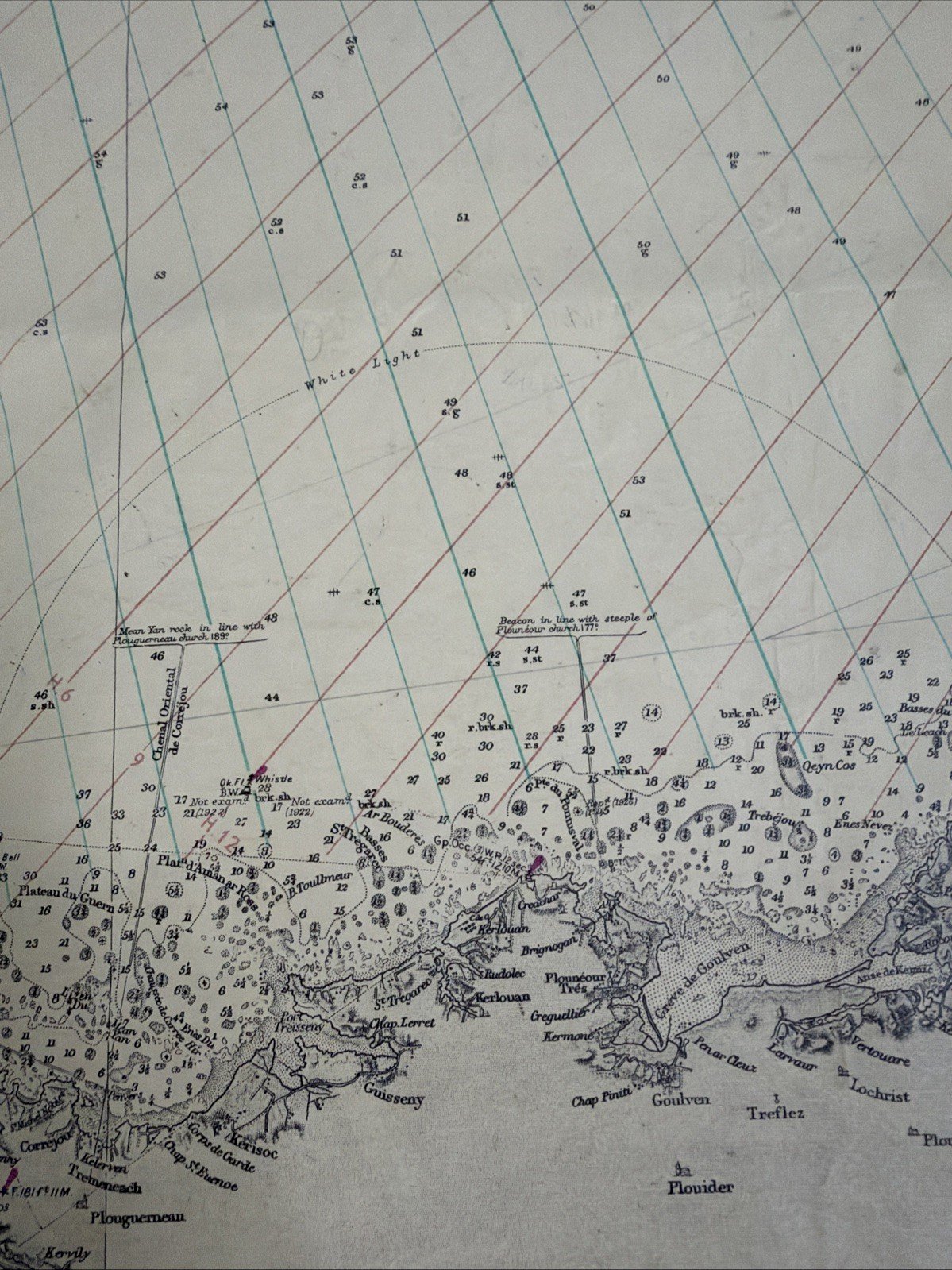
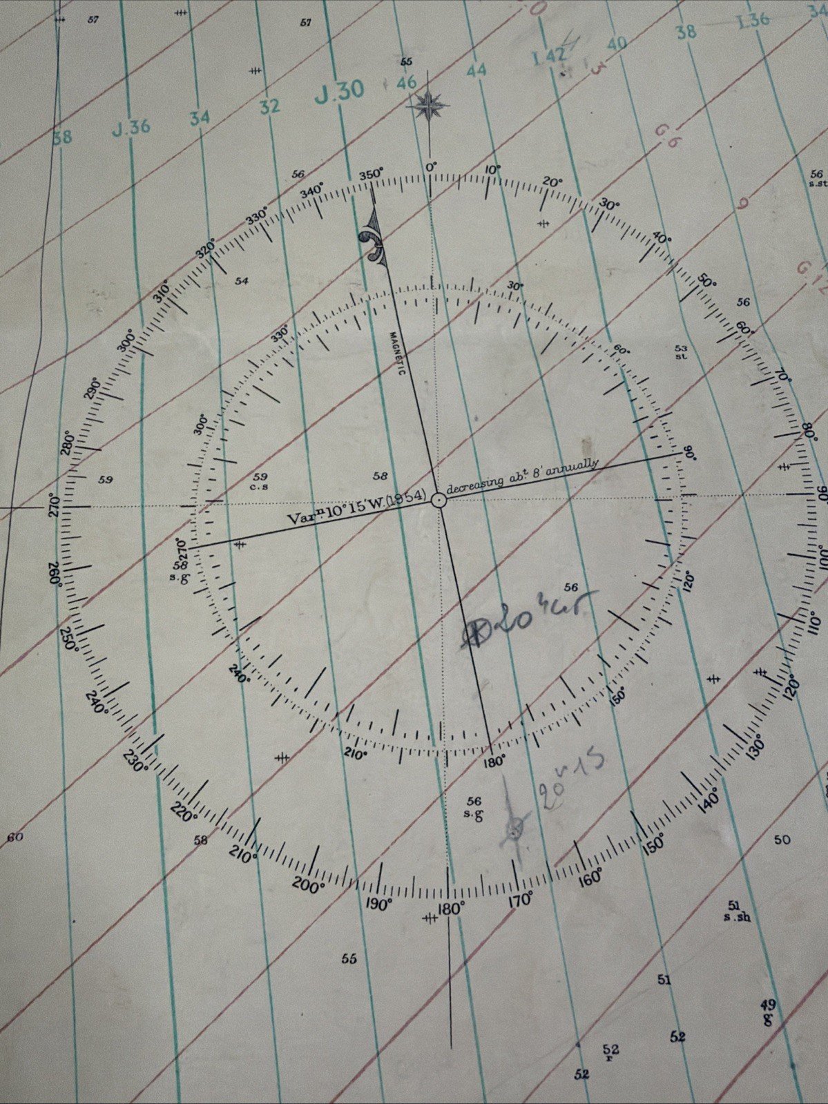
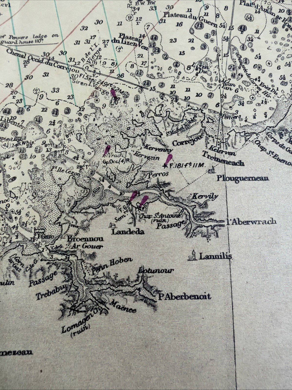
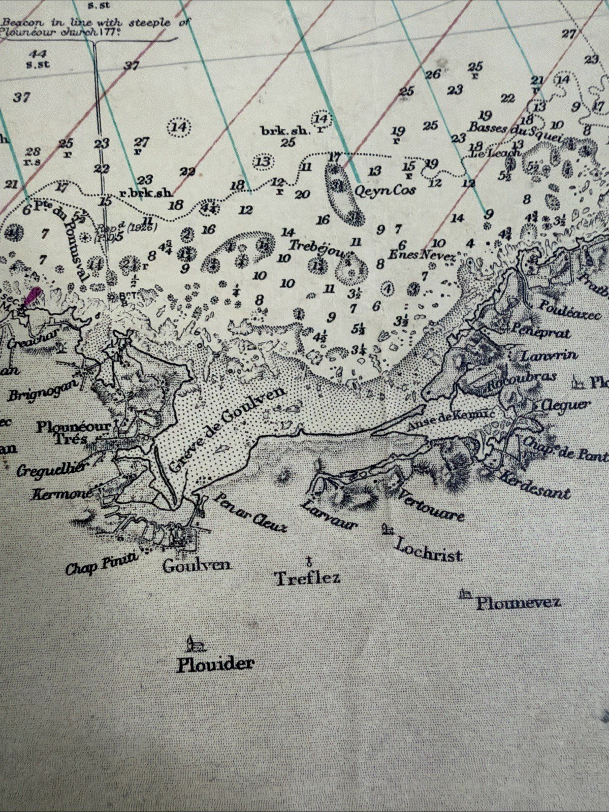
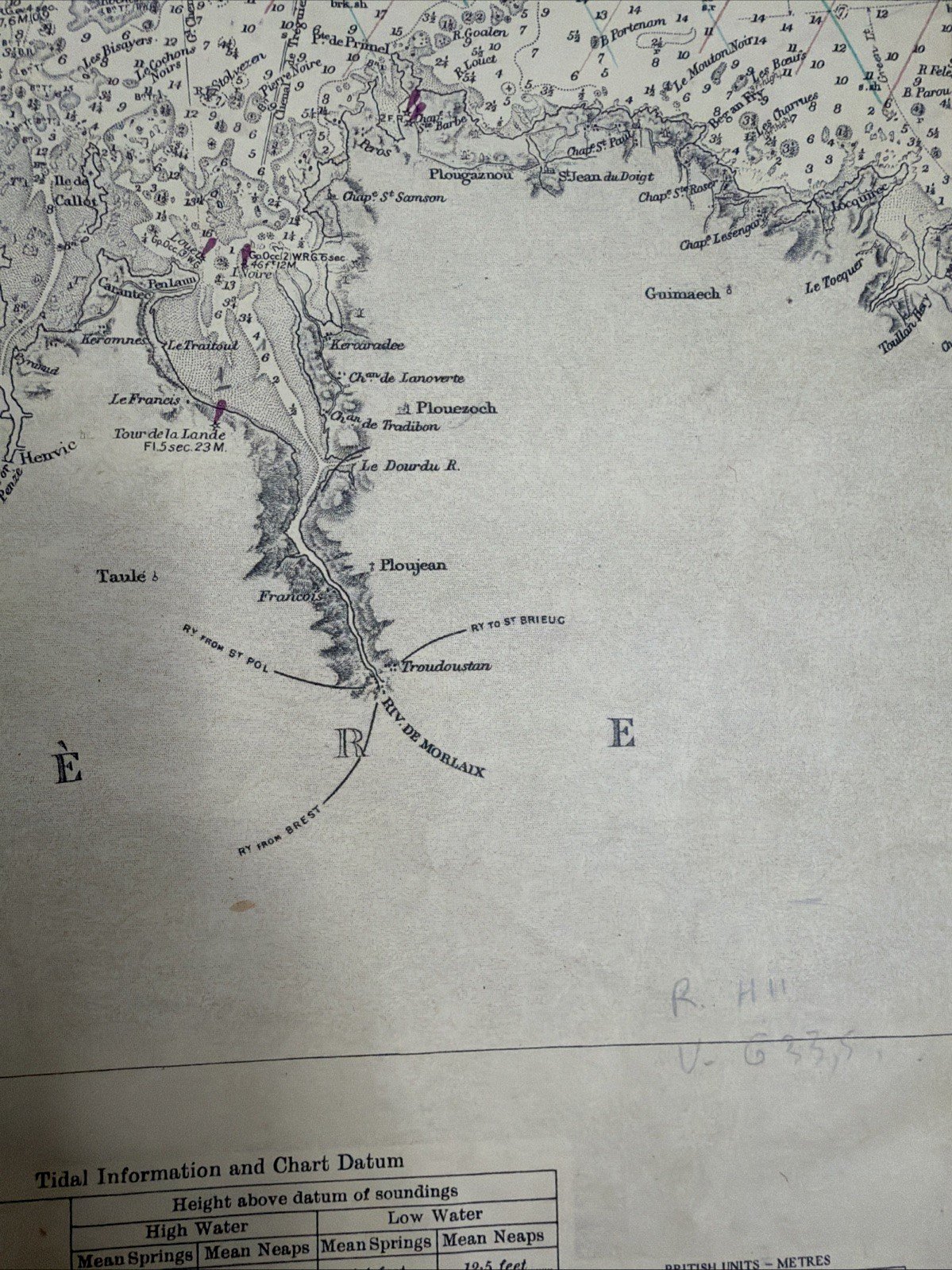
Large original marine chart of the British Admiralty – Brittany, Ouessant, Paimpol – Decca Chart – 1957/1958 – 131 × 71 cm Exceptional and spectacular large-format antique nautical chart published by the British Admiralty, dedicated to the northern coast of Brittany, from Ouessant (Ushant) to the Plateau des Roches-Douvres. This authentic hydrographic chart carries the reference: Admiralty Chart No. 2644 FRANCE – NORTH COAST – SHEET VIII USHANT TO PLATEAU DES ROCHES DOUVRES A nautical chart rich in history Cartography finds its origins in the works of the Pilote Français from 1823, as clearly indicated in the cartouche: “From the Pilote Français 1823” The chart was subsequently published by the British Admiralty on May 31, 1902, and has been continuously enhanced and corrected over time with the advances in hydrography and navigation. It notably bears the mentions: * New Edition – August 21, 1914 * March 8, 1920 * Decca Chart – September 20, 1957 * corrections and updates continued until 1958 The offered copy corresponds to a navigation edition used around 1957-1958, while retaining a cartography whose origins date back to the early 19th century. The famous Decca radionavigation system A particularly sought-after feature of this copy: the chart includes the spectacular colored network of the system: DECCA CHART – CHAIN 1 (S.W. British) The green and red lines crossing the channel correspond to the hyperbolic network of the Decca Navigator System, one of the major radionavigation systems used in the mid-20th century before the advent of satellite systems. The piece thus embodies the fascinating encounter between the traditional hydrography of the 19th century and the birth of modern electronic navigation. An extraordinary representation of maritime Brittany The chart offers a remarkable level of detail. It notably includes: Ouessant – Ushant – Lampaul – Finistère – Ploumanac’h – Trébeurden – Lézardrieux – Paimpol – Bréhat – Sept-Îles – Roches-Douvres, as well as a multitude of ports, lighthouses, reefs, shoals, and navigation markers. The sea is covered with hundreds of bathymetric soundings, shipping routes, bearings, navigation roses, and technical indications. Its large graduated roses and its Decca network give the whole an exceptional graphic strength. An absolutely remarkable patina This chart possesses primarily what is sought today in a genuine ancient maritime document: an authenticity and patina impossible to reproduce artificially. The paper features: * a beautiful naturally aged ivory tone; * ancient folds; * traces of use; * some stains and old marks; * wear and small marginal tears; * some fragilities at the folds; * old annotations and highlights related to its use. These marks are not hidden: they instead constitute the moving testimony of the life of this genuine professional navigation chart. It was not created as a decorative object. It has served. And this is precisely what gives it its exceptional presence today. Very large format Dimensions: approximately 131 × 71 cm Its monumental size makes it particularly spectacular once displayed on the wall. It will naturally find its place in a: cabinet of curiosities, library, seaside house, yacht club, architect's office, collector's interior, marine decor, or collection dedicated to the history of navigation. A piece for collectors This large chart will appeal to enthusiasts of: ancient cartography, nautical charts, hydrography, Brittany, French navy, Royal Navy, British Admiralty, maritime history, radionavigation, Decca system, nautical instruments, and antique scientific documents. It is an original period document, not a contemporary decorative reproduction. Its association of cartography derived from the Pilote Français of 1823, Admiralty edition, successive corrections, and the Decca network from the 1950s makes it a remarkable synthesis of over a century of maritime navigation evolution. Characteristics * Item: large marine chart / hydrographic chart * Title: France – North Coast – Sheet VIII * Area: Ushant / Ouessant to Plateau des Roches Douvres * Reference: British Admiralty Chart No. 2644 * Original cartography: Pilote Français, 1823 * Admiralty publication: May 31, 1902 * New edition: August 21, 1914 * Revision: March 8, 1920 * Decca version: September 20, 1957 * Visible corrections: until 1958 * System: Decca Navigator – Chain 1 S.W. British * Dimensions: 131 × 71 cm * Condition of the copy: 1950s * Origin: Great Britain / British Admiralty * Subject: Brittany – Channel – maritime navigation * State: used condition with patina, folds, marks, stains, and visible accidents in photographs * Authenticity: original period document Keywords collectors / SEO ancient marine chart, antique nautical chart, hydrographic chart, Admiralty Chart, British Admiralty Chart, Admiralty nautical chart, antique nautical chart, vintage nautical chart, marine navigation chart, sea chart, France North Coast, Brittany nautical chart, Bretagne marine chart, Ouessant antique chart, Ushant chart, Paimpol marine chart, Bréhat antique chart, Ploumanac’h, Lézardrieux, Roches Douvres, Pilote Français 1823, Hydrographic Office, Royal Navy chart, Decca Chart, Decca Navigator, Decca Navigation System, radionavigation, maritime navigation, maritime history, French navy, British navy, Royal Navy, hydrography, bathymetry, ancient cartography, antique map, maritime map, nautical decor, coastal map, cabinet of curiosities, marine decor, yacht club decor, maritime collectible, naval history, scientific instrument, historical navigation, vintage maritime decor, large format antique chart.
Réf :
#409561
Related Products





Comments
Rare large original marine chart of the British Admiralty Brittany Ouessant
220€
77260 La-Ferté-sous-Jouarre
Ce site contient des liens d’affiliation pour lesquels je peux recevoir une compensation.
Description
Large original marine chart of the British Admiralty – Brittany, Ouessant, Paimpol – Decca Chart – 1957/1958 – 131 × 71 cm Exceptional and spectacular large-format antique nautical chart published by the British Admiralty, dedicated to the northern coast of Brittany, from Ouessant (Ushant) to the Plateau des Roches-Douvres. This authentic hydrographic chart carries the reference: Admiralty Chart No. 2644 FRANCE – NORTH COAST – SHEET VIII USHANT TO PLATEAU DES ROCHES DOUVRES A nautical chart rich in history Cartography finds its origins in the works of the Pilote Français from 1823, as clearly indicated in the cartouche: “From the Pilote Français 1823” The chart was subsequently published by the British Admiralty on May 31, 1902, and has been continuously enhanced and corrected over time with the advances in hydrography and navigation. It notably bears the mentions: * New Edition – August 21, 1914 * March 8, 1920 * Decca Chart – September 20, 1957 * corrections and updates continued until 1958 The offered copy corresponds to a navigation edition used around 1957-1958, while retaining a cartography whose origins date back to the early 19th century. The famous Decca radionavigation system A particularly sought-after feature of this copy: the chart includes the spectacular colored network of the system: DECCA CHART – CHAIN 1 (S.W. British) The green and red lines crossing the channel correspond to the hyperbolic network of the Decca Navigator System, one of the major radionavigation systems used in the mid-20th century before the advent of satellite systems. The piece thus embodies the fascinating encounter between the traditional hydrography of the 19th century and the birth of modern electronic navigation. An extraordinary representation of maritime Brittany The chart offers a remarkable level of detail. It notably includes: Ouessant – Ushant – Lampaul – Finistère – Ploumanac’h – Trébeurden – Lézardrieux – Paimpol – Bréhat – Sept-Îles – Roches-Douvres, as well as a multitude of ports, lighthouses, reefs, shoals, and navigation markers. The sea is covered with hundreds of bathymetric soundings, shipping routes, bearings, navigation roses, and technical indications. Its large graduated roses and its Decca network give the whole an exceptional graphic strength. An absolutely remarkable patina This chart possesses primarily what is sought today in a genuine ancient maritime document: an authenticity and patina impossible to reproduce artificially. The paper features: * a beautiful naturally aged ivory tone; * ancient folds; * traces of use; * some stains and old marks; * wear and small marginal tears; * some fragilities at the folds; * old annotations and highlights related to its use. These marks are not hidden: they instead constitute the moving testimony of the life of this genuine professional navigation chart. It was not created as a decorative object. It has served. And this is precisely what gives it its exceptional presence today. Very large format Dimensions: approximately 131 × 71 cm Its monumental size makes it particularly spectacular once displayed on the wall. It will naturally find its place in a: cabinet of curiosities, library, seaside house, yacht club, architect's office, collector's interior, marine decor, or collection dedicated to the history of navigation. A piece for collectors This large chart will appeal to enthusiasts of: ancient cartography, nautical charts, hydrography, Brittany, French navy, Royal Navy, British Admiralty, maritime history, radionavigation, Decca system, nautical instruments, and antique scientific documents. It is an original period document, not a contemporary decorative reproduction. Its association of cartography derived from the Pilote Français of 1823, Admiralty edition, successive corrections, and the Decca network from the 1950s makes it a remarkable synthesis of over a century of maritime navigation evolution. Characteristics * Item: large marine chart / hydrographic chart * Title: France – North Coast – Sheet VIII * Area: Ushant / Ouessant to Plateau des Roches Douvres * Reference: British Admiralty Chart No. 2644 * Original cartography: Pilote Français, 1823 * Admiralty publication: May 31, 1902 * New edition: August 21, 1914 * Revision: March 8, 1920 * Decca version: September 20, 1957 * Visible corrections: until 1958 * System: Decca Navigator – Chain 1 S.W. British * Dimensions: 131 × 71 cm * Condition of the copy: 1950s * Origin: Great Britain / British Admiralty * Subject: Brittany – Channel – maritime navigation * State: used condition with patina, folds, marks, stains, and visible accidents in photographs * Authenticity: original period document Keywords collectors / SEO ancient marine chart, antique nautical chart, hydrographic chart, Admiralty Chart, British Admiralty Chart, Admiralty nautical chart, antique nautical chart, vintage nautical chart, marine navigation chart, sea chart, France North Coast, Brittany nautical chart, Bretagne marine chart, Ouessant antique chart, Ushant chart, Paimpol marine chart, Bréhat antique chart, Ploumanac’h, Lézardrieux, Roches Douvres, Pilote Français 1823, Hydrographic Office, Royal Navy chart, Decca Chart, Decca Navigator, Decca Navigation System, radionavigation, maritime navigation, maritime history, French navy, British navy, Royal Navy, hydrography, bathymetry, ancient cartography, antique map, maritime map, nautical decor, coastal map, cabinet of curiosities, marine decor, yacht club decor, maritime collectible, naval history, scientific instrument, historical navigation, vintage maritime decor, large format antique chart.
Réf :
#409561