English
  Français


Aaaarrh... This product has been given a new life; check out our similar products below or tell us about them ici , on cherche pour vous !
Related Products


Description
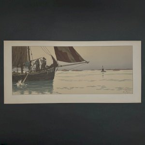
Engraving 17th General Government of Orléans Le Maine Le Perche Beauce Gastinois Nicolas Sanson D'Abbeville L4015 This engraved map of Nicolas Sanson d'Abbeville dates from 1651. Nicolas Sanson (1600-1667), sometimes called Nicolas Sanson d'Abbeville or Sanson d 'Abbeville, was the most important French cartographer of the 17th century. Tooley called Sanson "the founder of the French school of cartography". He began making maps in late 1620, and in 1630 he worked with Melchior Tavernier. Subsequently, Sanson worked in concert with the editor-in-chief of the press Pierre Mariette, with whom he published his large atlas: general maps of all parts of the world (1658). After Sanson's death in 1667, his son Guillaume managed the company in collaboration. It has a 20th century pitch pine frame. We report traces, bites, an accident on the glass, marks on the map. However, everything remains in an acceptable general condition. Our numerous photos allow you to appreciate the quality of the object. For the condition, please detail the photos. Feel free to zoom in. The photos are an integral part of the description. Dimensions: Frame Height: 54.5 cm Width: 59.5 cm Thickness: 1.5 cm Card Height: 50 cm Width: 65 cm I remain at your disposal for any questions.
Réf :
#201550
Color(s) : Multicolored / Natural
Material : Wood
Comments
Related Products
Description
Engraving 17th General Government of Orléans Le Maine Le Perche Beauce Gastinois Nicolas Sanson D'Abbeville L4015 This engraved map of Nicolas Sanson d'Abbeville dates from 1651. Nicolas Sanson (1600-1667), sometimes called Nicolas Sanson d'Abbeville or Sanson d 'Abbeville, was the most important French cartographer of the 17th century. Tooley called Sanson "the founder of the French school of cartography". He began making maps in late 1620, and in 1630 he worked with Melchior Tavernier. Subsequently, Sanson worked in concert with the editor-in-chief of the press Pierre Mariette, with whom he published his large atlas: general maps of all parts of the world (1658). After Sanson's death in 1667, his son Guillaume managed the company in collaboration. It has a 20th century pitch pine frame. We report traces, bites, an accident on the glass, marks on the map. However, everything remains in an acceptable general condition. Our numerous photos allow you to appreciate the quality of the object. For the condition, please detail the photos. Feel free to zoom in. The photos are an integral part of the description. Dimensions: Frame Height: 54.5 cm Width: 59.5 cm Thickness: 1.5 cm Card Height: 50 cm Width: 65 cm I remain at your disposal for any questions.
Réf :
#201550
Color(s) : Multicolored / Natural
Material : Wood