 English
  Français
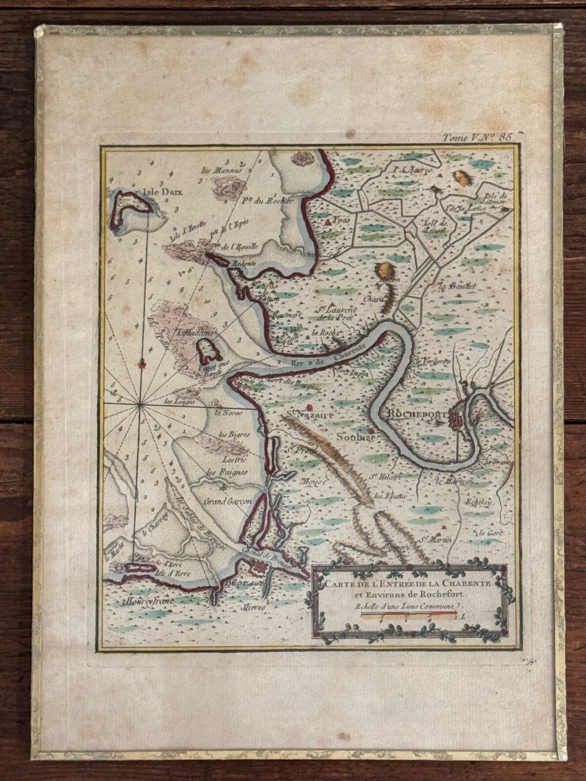
Description
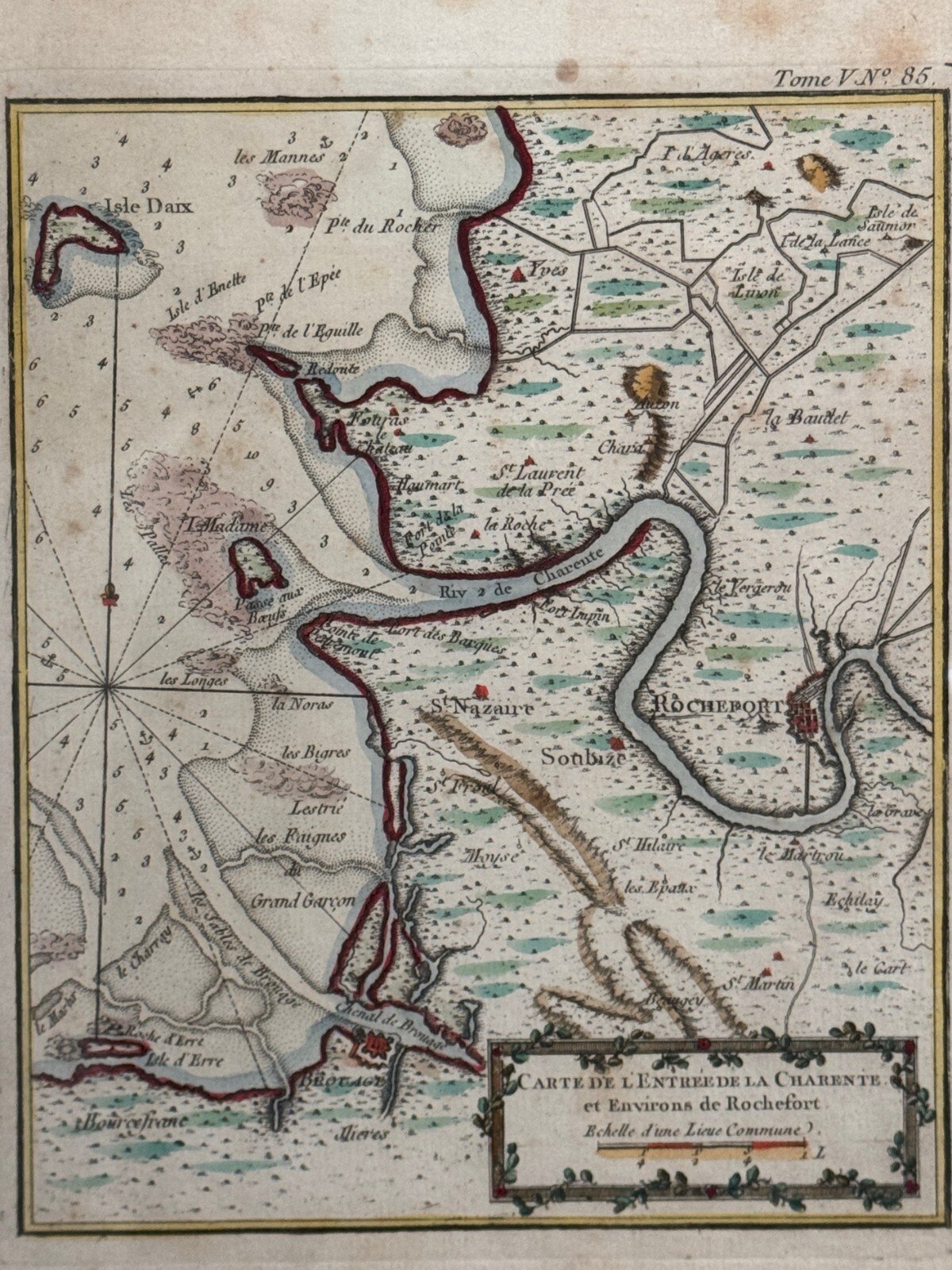
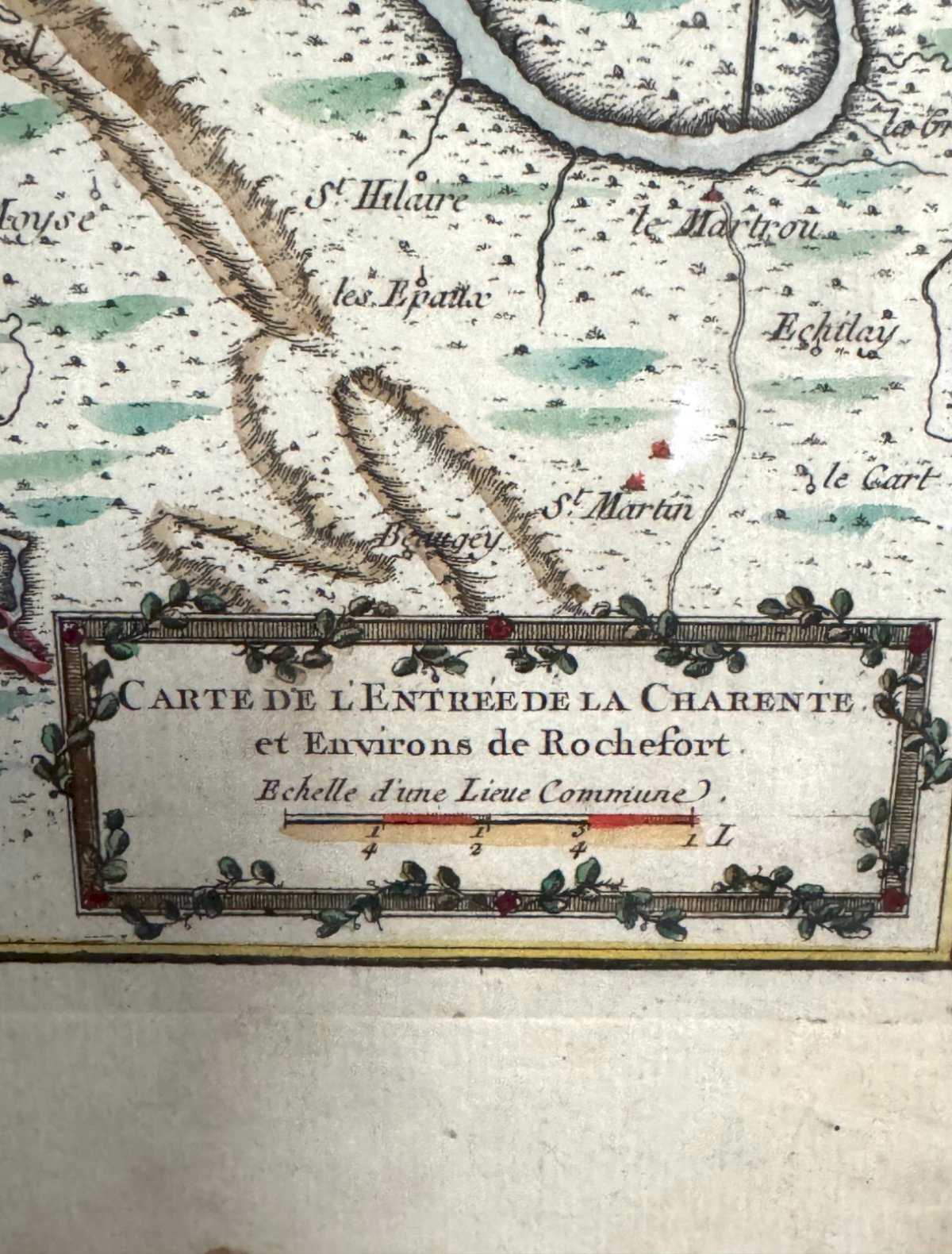
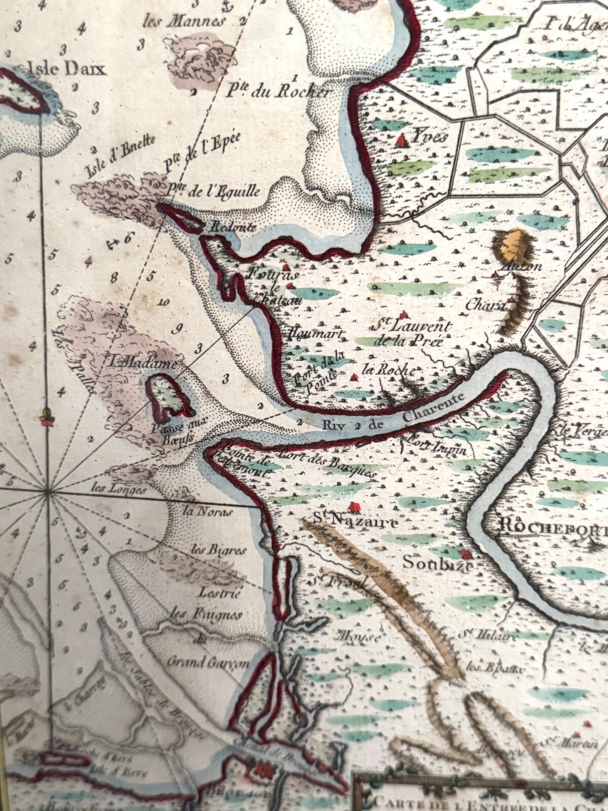
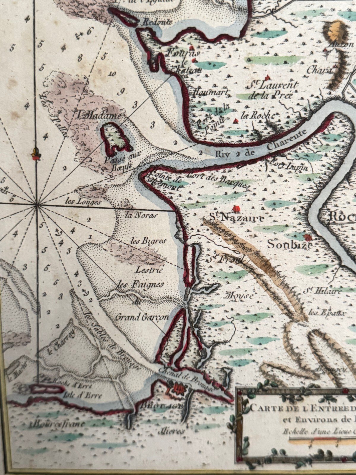
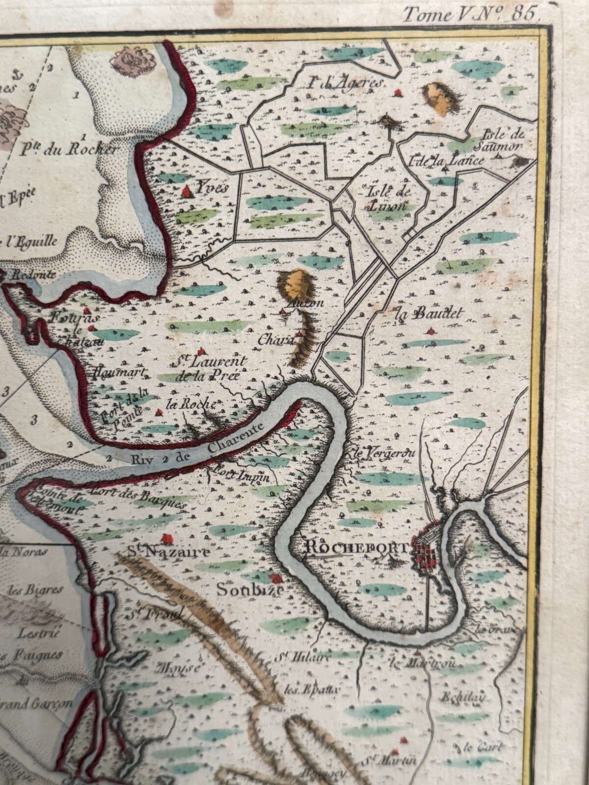
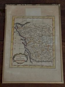
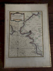
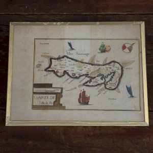
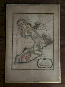
18th Century Colored Engraving Map of the Entrance of Charente and Surroundings of Rochefort L9210 This color map is from the 18th century. It was framed under glass in the 1960s. It is in generally acceptable condition, but not perfect, with some spots of foxing. Our photos allow you to appreciate the quality of the work. For the condition, please refer to the detailed photos. Feel free to zoom in. The photos are an integral part of the description. Dimensions: Frame Height: 32 cm Width: 22 cm View Height: 22 cm Width: 17 cm P: 1572502 I remain at your disposal for any questions. Type: Engraving Period: 19th Century and earlier Support: On paper Height: 32 cm Features: Framed Theme: Geographic map Width: 22 cm
Réf :
#340697
Dimensions :
L : cm W : 22.0 cm H : 32.0 cm
Related Products


Comments
18th century colored engraving map of the Entrance of Charente L9210
250€
44000 Nantes
Ce site contient des liens d’affiliation pour lesquels je peux recevoir une compensation.
Description
18th Century Colored Engraving Map of the Entrance of Charente and Surroundings of Rochefort L9210 This color map is from the 18th century. It was framed under glass in the 1960s. It is in generally acceptable condition, but not perfect, with some spots of foxing. Our photos allow you to appreciate the quality of the work. For the condition, please refer to the detailed photos. Feel free to zoom in. The photos are an integral part of the description. Dimensions: Frame Height: 32 cm Width: 22 cm View Height: 22 cm Width: 17 cm P: 1572502 I remain at your disposal for any questions. Type: Engraving Period: 19th Century and earlier Support: On paper Height: 32 cm Features: Framed Theme: Geographic map Width: 22 cm
Réf :
#340697
Dimensions :
L : cm W : 22.0 cm H : 32.0 cm